
Lines on a map
- Sep 8, 2020
- 2 min read

Some of my observations:
1. Many planned Light Rapid Transit (LRT) lines did not materialise. There were plans for lines in Jurong (even running to Jurong Island), Tuas, Sembawang and Yishun, Bedok, and an arc running from Marina East to Labrador Park - all these never happened. I doubt they will, considering how the bumbling Bukit Panjang LRT Line has been both expensive and problematic since it opened in 1999. If precious money is to be spent on rail lines, might as well build MRT lines to serve as many people as possible. History has shown that wherever an MRT line opens, the volumes of commuter crowds usually follow.

2. Major MRT lines planned in 2001 which never happened: A northern line (in light green) running from Sembawang to Changi Airport; a northeastern line (in pink) running from Seletar to future reclaimed land south of Marine Parade and East Coast Park; a southwestern line (in light red) running from Somerset to Jurong. I’ve recommended building variations of these lines in my book Jalan Singapura - these would collectively be a vast improvement to islandwide public transport connectivity.
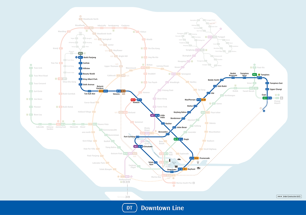
3. The future Downtown Line extension to Sungei Kadut is similar to what had been planned in 2001, except that 2001 suggested the extension be lengthened northward to Woodlands. I’ve always thought such an extension, covering the ageing neighbourhood of Marsiling and ending at Woodlands MRT Interchange, should be considered. It makes sense to complete the loop, so to speak, and the extension would greatly benefit people living and working in the north.

4. It’s good that a planned LRT line for Jurong has been upsized to the Jurong Region Line, which also connects Choa Chu Kang and Bukit Batok. But considering the geographical vastness and size of the population of the Tuas-Jurong region, I still feel a new MRT line is needed to connect the whole area to the City, at least to relieve pressure on the ageing East West Line. I have also suggested this in Jalan Singapura.
5. 2001’s Bukit Timah Line was merged with the Eastern Region Line to create the present Downtown Line; the Thomson Line was merged with an East Coast line to get the present Thomson-East Coast Line. Merging planned lines is good - this reduces the number of transfers needed. Commuters generally prefer direct routes and fewer transfers.
6. It’s distressing to be reminded that the Circle Line of 2001 was subsequently rerouted to cover the Bukit Brown area. Future development of the entire historic region still remains very much on the cards.
7. I wonder if the planned reclamation of islands south of Marine Parade and East Coast Park would ever materialise. Sounds like an attractive notion, creating lots of land for seafront housing and recreation which could then free up space elsewhere, although I think the residents of Marine Parade and East Coast Road-Upper East Coast Road would violently object to having their coastline retreat from them!

Comments