
In May 2021, I blogged about my endeavour to retrace the easternmost portion of the Jurong Railway Line from its origin near Bukit Timah Railway Station to the Clementi Road Railway Tunnel.
In December 2022, I continued this retracing, covering the railway line west from Clementi Road.
I then archived the photos and videos until recent news broke of Maju Forest's impending demise.
As a significant portion of the Jurong Railway Line runs through the Maju Forest, I am now blogging about my 2022 exploration to put on record my journey and observations.
In my previous post about the Jurong Railway Line, I mentioned my interest in searching for the footnotes of history. These footnotes, on the periphery of physical and mental spaces, are frequently under threat of obliteration. This is a real possibility for the Jurong Railway Line inside Maju Forest.
Part I: Crossing Maju Forest
Back in December 2022, I travelled once again to Bus Stop 12089 opposite Maju Camp, the same start point as my exploration of Clementi Forest (Point A in the map below).

Base picture credit: Google Maps.
I descended the slope into the railway tunnel.

While I headed east into Clementi Forest in 2021, this time, I headed west into Maju Forest, named after Maju Camp.


I was immediately reminded that the railway track was laid on a cutting carved out of the terrain – the sides of the track were flooded by stagnant water thick with mud. The afternoon air was still and heavy with jungle humidity.


The first part of the track in Maju Forest heading west was relatively easy to traverse, despite the dense undergrowth and the occasional fallen tree.


Decades of abandonment meant trees were also growing over the track.

All around me, trees towered up to four storeys above me.


Slightly more than 200 metres inside the forest, at roughly this location (below), I received a rude shock – I suddenly came face-to-face with a huge wild boar!
This specimen was higher than my waist level in height, and was only a few metres from me. I froze for a split second, then turned tail and clambered through the undergrowth in the opposite direction as fast as I could. I had to return to where I had started as there were steep, forest-covered slopes on both sides.
Thankfully, the boar did not choose to chase after me. I climbed up the slope behind Bus Stop 12089 and waited until the boar passed by. Below is a still from a video I took of the boar waddling east into Clementi Forest:

I continued waiting for a few minutes until I was sure the coast was clear, before reentering the forest.
Around 300 metres in, the ground started becoming wetter and muddier...


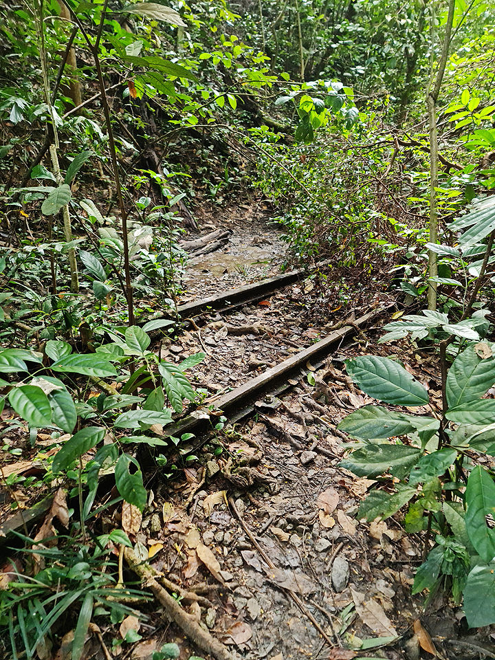
... and the track gradually disappeared below mud and dense undergrowth.

Part of the track reappeared above the thick mud for a short while...

... then disappeared again. Heavy-duty hiking boots needed here!

I was at Point B below.

Base picture credit: Google Maps.
From here on, I had to clamber onto higher ground next to the track, and head west-south-west, following what I knew was the historical alignment of the track. Fortunately, like when I was in Clementi Forest, the alternate path next to the buried track was relatively easy to traverse, and it closely hugged the track the whole way.

The track only reappeared a short distance before the Sunset Way Railway Bridge.


I had reached Point C below.

Base picture credit: Google Maps.
Part II: Two railway bridges
The Sunset Way Railway Bridge itself was closed, but it was easy to cross Sunset Way (below) and head up the other side.

A view of the track facing Maju Forest.

The track continued west-south-west until it reached the Sungei Ulu Pandan Railway Bridge, which was also closed.


The Sungei Ulu Pandan Railway Bridge.

A view of the track atop the bridge from behind the barrier.

The complete map of my westward route from the Clementi Road Railway Tunnel to the Sungei Ulu Pandan Bridge.

Base picture credit: Google Maps.
This time, meeting up with the track on the other side required a longer detour. I had to head southeast along the park connector to a covered linkway over the river, cross over, then head northwest back to the track.
Part III: The Clementi Avenue 4 glade
The track continued along a quiet, delightful glade between the Clementi Avenue 4 blocks and the Sungei Ulu Pandan.


Not a common sight – the track running across a foot path.

A short distance after running under a flyover carrying Clementi Avenue 6 over the Sungei Ulu Pandan, the track abruptly ends before Clementi NorthArc, which was under construction at the time, but was completed in early 2023.


And herein concludes the second leg of my exploration of the Jurong Railway Line.

Base picture credit: Google Maps.
There is a possibility that the Jurong Railway Line inside Maju Forest could be conserved as part of a nature trail next to the planned housing estate, but there is no guarantee of this happening.
I hope a greater portion of the Maju Forest can be conserved alongside Clementi Forest as irreplaceable green lungs and heritage ecosystems in Singapore’s southwest.


