top of page

Blog

Blog Picture.jpg
Search

Paid a visit to Cathay Cineplex, because it is shutting for good tomorrow, 26 June, after 16 years in The Cathay at 2 Handy Road.

ree

Media company mm2 Asia, which acquired Cathay’s cineplexes in Singapore in 2017, said the decision to close Cathay Cineplex was a business one, part of “cost rationalisation for its cinema operations”.


In simple English - the cineplex business in Singapore is bleeding money.


Actually, the cinematic lineage of Cathay Cineplex goes back further, more than eight decades to 1939, when Cathay Cinema opened in the Cathay Building. At the time, Cathay Building was the tallest building not just in Singapore, but all of Southeast Asia; Cathay Cinema was Singapore’s first air-conditioned theatre.

ree
Cathay Building. Credit: Courtesy of National Archives of Singapore.

Cathay Cinema operated from 1939 to 1942, and from 1946 to 2000, the only break happening because of the Japanese Occupation. From 2000 to 2006, Cathay Building and Cathay Cinema were redeveloped into The Cathay and Cathay Cineplex; only the iconic facade of the cinema was conserved.

ree
Cathay Cinema in 1953. Credit: SPH Media Trust.

The name of the building was derived from the name of the cinema or cineplex. The Cathay won’t be the same after Cathay Cineplex is gone.


When I was younger and watched more movies, I frequented the cineplexes in the Orchard area - Lido Cineplex at Shaw House, Cathay Cineleisure Orchard, and Cathay Cineplex at The Cathay. Another landmark from my younger days will cease to be.

ree

The large TV screen near the box office showing the latest trailers.
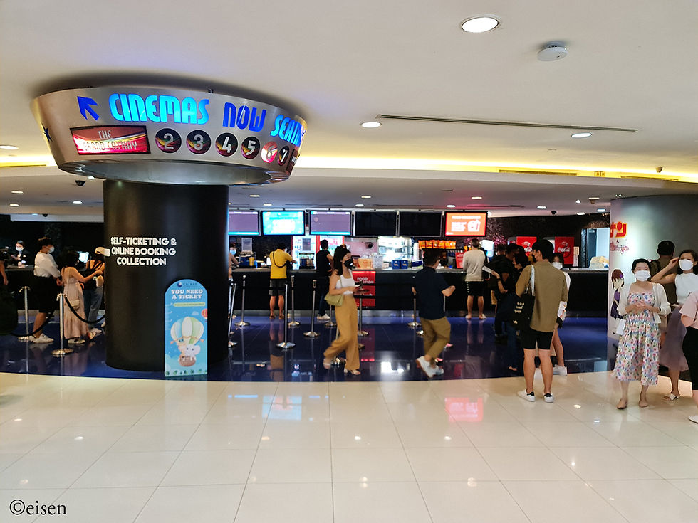
ree

The box office.

ree

ree

ree

ree

The escalators to the floor above, where the halls were.

ree

The entrance to the halls.

ree

The tenants of The Cathay don’t seem to be doing very well. Expect more black dashes to appear on the tenant list in the months to come.

ree


Amidst the shophouses of the Joo Chiat area, there is a public car park at Joo Chiat Place, and tucked away in a corner of the car park is a Datuk Gong shrine.

ree

The shrine is under what I believe is a ficus tree, a tree significant in three faiths which originated from South Asia - Hinduism, Buddhism, and Jainism.


The bright yellow of the shrine and the steps leading up to it makes it easy to spot from afar.

ree

The structure of the shrine looks modular, units stacked atop and alongside one another like Lego bricks, as if different parts were gradually added over time - which is usually the case for roadside shrines started and maintained by the community.

The centre altar is dedicated to Datuk Gong himself. The banner above has the Chinese characters, “Na Du Gong” - the Chinese for “Datuk Gong”.

ree

There is no deity figure. Instead, he is represented by a stone wrapped in yellow cloth on the left, a tablet in the middle, and a walking stick on the right.

ree

The top left altar is dedicated to an interesting entity - Nang Kwak, a Thai deity. She is dressed in red Thai-style clothing, and has a golden crown on her head. Her right hand is raised as if beckoning someone.

ree

Nang Kwak is a deity of good fortune and prosperity, believed to bring money to a household or business. Here, on top of the usual altar offerings, perfume and makeup have also been bequeathed to her.


On the right side of the shrine, there are three altars. The top altar is accordingly dedicated to “Tian Guan”, or “Officials of Heaven”.


At the bottom, there are two altars. The one on the left is dedicated to Da Er Ye Bo, the famous pair of attendants who escort the deceased to the 10 Courts of Hell for judgement. The banner above them reads “Jiu Dian Da Er Ye Bo”; “Jiu Dian” means “Court 9”, which could be a reference to the 9th Court of Hell.

ree

ree

Finally, the altar on the right contains a tablet dedicated to the Earth Deity of the area.

ree

A joss urn next to the shrine attracted my attention. It was at the foot of the ficus tree.

ree

Above the joss urn, an amulet hung from a branch.

ree

It was an amulet for the God of Wealth (Cai Shen), from the Sembawang God of Wealth Temple at Admiralty Street.


Perhaps, in the future, we’ll see a proper altar built for the God of Wealth, added to the shrine?


Upon studying Google Street View’s history, I was surprised to learn that the Joo Chiat Place Car Park Datuk Gong Shrine is just a few years old.


Up to 2013, the car park did not exist; instead, there was a field in front of the ficus tree.

ree
2013. Credit: Google Maps.

Sometime between 2013 and 2015, the car park was built; the ficus tree was pared back to make way for the car park, but fortunately, it was not totally felled. There was an exposed mound between the tree and the car park.

ree
2015. Credit: Google Maps.

Between March 2015 and September 2016, the Datuk Gong altar appeared on the mound - which means it is only six to seven years old.

ree
2016. Credit: Google Maps.

From 2018, more altars were added to the shrine.


I hope the community will continue maintaining this shrine, and I hope that the authorities will leave the shrine alone.


The North-South Corridor, Singapore’s 11th expressway, is currently being built across the width of the island. There is a line of construction sites stretching 21 kilometres from Woodlands in the north to Marina Bay in the south, and it will take another four years before the expressway opens in 2026. It will be Singapore’s costliest expressway, with a price tag of up to $8 billion.


The expressway will be a crucial transport link connecting the towns of Woodlands, Sembawang, Yishun, Ang Mo Kio, Bishan, and Toa Payoh with the City. Hence, construction has to take place inside built-up areas. I am interested in the impact of expressway construction on these towns, and as it will take another four years, this period is a good chance to track changes in the suburban landscape.


The northern stretch covering Sembawang and Yishun will be an aboveground viaduct, which will transition to an underground tunnel as Yishun gives way to Ang Mo Kio.


I recently explored the construction sites running down the width of Ang Mo Kio town. Travelling south to north, I covered stretches of Marymount Road and Ang Mo Kio Avenue 6, from Bishan-Ang Mo Kio Park to Yio Chu Kang MRT Station.

Below is a map of Ang Mo Kio town; the yellow line is the future North-South Corridor. Virtually the entire line is a continuous stretch of construction sites; I spent an afternoon travelling along the line, taking photos and notes.

ree
Base picture credit: Streetdirectory.com.

Along Marymount Road.

ree

Marymount Road, facing north, approaching the junction with Ang Mo Kio Avenue 1. The area adjoining the road is adorned by Singapore’s national bird, the (construction) crane.

ree

The junction of Marymount Road and Ang Mo Kio Avenue 1, facing north. Marymount Road is temporarily curved because of construction. Residents living around this junction will have to endure this state of affairs for up to 2030 - after the North-South Corridor is done, Teck Ghee MRT Station of the Cross Island Line will have to be built.

ree

Marymount Road, facing south, between Sin Ming Avenue (background) and Ang Mo Kio Avenue 1 (foreground), from the 30th and top floor of Block 310A Ang Mo Kio Avenue 1. The curves in the once-straight road are apparent here.

ree

The junction of Marymount Road and Ang Mo Kio Avenue 1, facing south. The flats of Bishan town lie in the background.

ree

The junction of Ang Mo Kio Avenue 6 and Street 24, facing south, from the 11th and top floor of Block 203 Ang Mo Kio Avenue 3. Here, piling and other work were going on right next to the block of flats; the cranes felt so close to me I could have touched them with a pole. I felt sorry for the residents trapped by the constant cacophony.

ree

A colourful sound barrier in front of Block 119 Ang Mo Kio Avenue 3.

ree

Construction sites next to Ang Mo Kio Avenue 6, facing south, from the 25th and top floor of Block 700B Ang Mo Kio Avenue 6. At the bottom is the junction with Ang Mo Kio Avenue 3.

ree

Ang Mo Kio Avenue 6, facing north, to the east of Ang Mo Kio Town Garden West. The construction has split in half the once-straight road.

ree

The junction of Ang Mo Kio Avenue 6 and Avenue 5, facing south, from the 13th and top floor of Block 646 Ang Mo Kio Avenue 6.

ree

A sound barrier in front of Block 649 Ang Mo Kio Avenue 5.

ree

Many photos were made possible by common corridors of flats facing the main road. This is generally more common in older flats. Ang Mo Kio town is a relatively old town, so I am fortunate to be able to track the construction of the North-South Corridor from good vantage points.


Copyright © 2025 Eisen Teo. Proudly created with Wix.com

bottom of page