top of page

Blog

Blog Picture.jpg
Search

A semi-expressway is being built in the northern part of Punggol town, north of Punggol Waterway, connecting Seletar North Link in the west to the road named Punggol East in the east.

ree
Punggol town. The semi-expressway is marked pink. Base picture credit: Streetdirectory.com.

Compared to an expressway, a semi-expressway has lower speed limits. Examples include West Coast Highway and Nicoll Highway with speed limits of 70km/h.


Here’s a shot of Punggol’s semi-expressway under construction, taken from the West Loop of the Punggol LRT Line.

ree

The semi-expressway lies on a slope overlooking Punggol Waterway, which had been excavated out of the natural landscape.

 
  • Jan 16, 2021

Singapore used to be covered by cemeteries. No thanks to urban renewal and redevelopment in a land-scarce, overcrowded city-state, most of these cemeteries have disappeared, but it’s fitting that we still have roads and places named after “Cemetery” in multiple languages.


For our national language Malay, there’s Jalan Kubor, or “Grave Road”, in Kampong Glam. The cemetery there predates the arrival of the British in 1819.

ree
Jalan Kubor Cemetery, as seen from Victoria Street.

For Hokkien, there’s Tiong Bahru in the south. “Tiong” is Hokkien for “Cemetery”; “Bahru” is Malay for “New”. Numerous Chinese cemeteries there have been exhumed.


For English, many roads in Choa Chu Kang Cemetery - the only cemetery in Singapore currently open to burials - have “Cemetery” in them. For example, Christian Cemetery Path 11, Muslim Cemetery Path 4, and Hindu Cemetery Path 1.

ree
Muslim Cemetery Path 4. Credit: Google Maps.

And as for Tamil, there’s Jalan Mayaanam, or “Graveyard Road”, a tiny road of around 140 metres, off Upper Changi Road North.

ree

I recently visited Jalan Mayaanam. Heading down Upper Changi Road North, blink and you’ll miss it. It’s a narrow, single-lane dual carriageway, with hardly any lane markings. It seems to serve only two functions: An alternative exit for vehicles from the Salvation Army’s Peacehaven Nursing Home and the Japanese School, and free parking space for heavy vehicles. Next to the road is Exit 1 of the Tampines Expressway, which sees a continuous flow of traffic.

ree
Jalan Mayaanam.
ree
Free parking for heavy vehicles.
ree
Plenty of erosion due to frequent parking.
ree
Mature trees next to the road.
ree
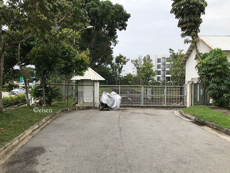
The end of the road just 140 metres in - locked gates of the Japanese School.

Jalan Mayaanam used to be far longer, running from the old Upper Changi Road to the now-defunct Tampines Road.

ree
A 1976 map of the area. The fragment of Jalan Mayaanam still surviving today is marked in blue. Jalan Mayaanam's "Graveyard" refers to the Hindu cemetery in the middle of the map, now expunged. Base picture credit: Survey Department.

In the 1980s, the road was sliced in half by the northward extension of Upper Changi Road East to Tampines Road; the extension was later incorporated into Tampines Expressway.


Most of the rest of the road was subsequently expunged, saved for the fragment which still exists today.


If the expressway had been planned several metres to the right, Jalan Mayaanam would not exist today.

ree
Credit: Streetdirectory.com.

The road got its name from the Hindu cemetery which used to exist to its east.


In 1982, The Straits Times described the cemetery as thus:


All the bodies, except for a few, are buried along one edge of the cemetery. There is an open hut 7 metres by 5 metres next to the entrance where the rituals before a burial take place.


There are two large 60-year-old trees, giving shade, ostensibly. They stand like sentinels, whispering to each other when the wind blows. A coconut tree, with its top sliced off by lightning, stands like an accusing finger. The white frangipani adds an unearthly fragrance to the atmosphere - an atmosphere of timelessness, for time has stopped for those who are here. The other half of the cemetery is a wide, open space of green grass, which gently dips towards one length of the boundary. From this half, the view is enchanting: a creamy blue sky forming a canopy over the luxurious green tops of trees.


The visitors come here to worship and worry. It is here that they feel hope and fear, grief and guilt, love and loath, all at once. It is simple yet stark; serene and yet uneasy. It is the place of eternal sleep. It is The Destination.

ree
The cemetery. Credit: Singapore Press Holdings.

Sadly, by the 1990s, the cemetery was exhumed; condominiums stand on the site today. As for Graveyard Road, it is largely forgotten, known only to the drivers of heavy vehicles who wish for free parking.

 
  • Jan 7, 2021

After a new National Development Minister - reputedly a nature buff - took over the portfolio last year, I had hoped for a fundamental relook at how land use is managed in Singapore. I had looked forward to the conservation of more forests and areas of natural heritage.


Not for Clementi Forest, it seems. The old trope of how “land-scarce, densely-populated Singapore must balance the needs of development and conservation” remains.

ree
Clementi Forest. Credit: Brice Li.
ree
Clementi Forest. Base picture credit: Google Maps.

Clementi Forest will continue to be earmarked for residential use, but there is “no immediate need” to develop the site for housing, said National Development Minister Desmond Lee yesterday.


In a written response to Dr Tan Wu Meng (Jurong GRC), Mr Lee noted that the site has been zoned for residential use since 1998.


“We will... retain the zoning of the site, while giving our future generations the option of deciding whether to use it for housing, if the need arises,” he said.


Drone footage of the green stretch near King Albert Park went viral last October, with nature enthusiasts later starting a petition to call for the area to be rezoned as a nature park.


Dr Tan had asked if any environmental impact studies had been done on the area, and if the land could be designated as a national park or nature reserve.


Workers’ Party MP Dennis Tan (Hougang) had also asked on Monday if the Ministry of National Development would consider reviewing the status of Clementi Forest and other forests earmarked for development.


In his response to both MPs, the minister stressed that land-scarce, densely populated Singapore will have to balance the needs of development and conservation. As part of long-term planning, land is set aside early for its potential use for future generations.


Mr Lee said: “In doing so, we endeavour to balance the demands and trade-offs across a variety of land-use needs, including that of housing, green spaces, infrastructure and workplaces.”


He pointed out that Singapore has, where possible, reviewed its plans to retain green spaces that could have been used for industry.


For instance, the Mandai mangroves and mudflats were initially planned for factory use. But the area’s ecological value led the authorities to preserve it as a nature park, Mr Lee said.


Other green spaces, such as Thomson and Windsor nature parks, could have been used for housing but are currently retained as green buffers to Singapore’s nature reserves, he added.


And yet other areas such as the Sungei Buloh Wetland Reserve and the upcoming Khatib Bongsu Nature Park were once prawn farming areas. These were abandoned, acquired by the Government, and have over time become green spaces inhabited by indigenous flora and fauna.


Clementi Forest was itself an abandoned rubber plantation that has become a secondary forest, Mr Lee added.


At present, about 7,800ha of land in Singapore is set aside for green spaces, ranging from nature reserves to parks and park connectors. An additional 1,000ha of green space will be added over the next 10 to 15 years.


“After weighing the alternatives and trade-offs, there will be areas that we cannot avoid developing,” Mr Lee said. “Nonetheless, for these sites, possible environmental impacts will still be carefully managed, and natural elements will be integrated within developments where possible.”


He added that there may be changes to how Singapore plans for office and industrial spaces as its economy transforms, with road space potentially freed up for other purposes as the country moves towards its vision of being car-lite.


***


Since Singapore is “land-scarce” and “densely-populated”... how about (further) reducing the number of golf courses.


In 2014, it was reported that Singapore had 14 private and three public golf courses, occupying a total of 1,500 hectares of land, or about 2 per cent of the Republic’s total land area.


Since then, two golf courses - Jurong Country Club and Raffles Country Club - have vacated their premises, and the land returned to the State for redevelopment, in 2017 and 2018 respectively.


Keppel Club will not have its lease extended after it expires at the end of 2021; likewise for the Marina Bay Golf Course, after its lease expires in 2024.


Altogether, about 200 hectares of land have been and will be freed up for other uses, leaving 1,300 hectares still dedicated to an activity largely reserved for the well-to-do - just 1 per cent of Singaporeans play golf.

ree
Island Golf Course, south of Lower Peirce Reservoir. Credit: Google Maps.
ree
Sembawang Golf Course, north of Mandai Avenue. Credit: Google Maps.
ree
Laguna National Golf & Country Club, NSRCC Golf Course, and Tanah Merah Golf Course, south of Changi Airport. Credit: Google Maps.

The authorities have acknowledged that “golfing and golf clubs are land intensive”, and that “there is a need to balance the competing demands for land”. And steps have been taken to pare down the amount of land taken up by golf courses. However, the cut is not significant enough. More precious land can and should be freed up for the greater good.


Redeveloping half the 1,300 hectares - 650 hectares - would be a good start.


For comparison, the entire Greater Bukit Brown area - immensely rich in both natural and cultural heritage - covers just 158 hectares.

ree
Bukit and Sime Golf Courses next to the Greater Bukit Brown area. Base picture credit: Google Maps.

It is possible for “land-scarce, densely-populated Singapore” to “balance the needs of development and conservation” - it is a case of assessing whether certain types of development, such as golf courses, really deserve the amount of land allocated to them.


Copyright © 2025 Eisen Teo. Proudly created with Wix.com

bottom of page