
- Apr 14, 2021
A forgotten road system that is almost 60 years old has been partially expunged.
The loop of Tanglin Halt Road and Tanglin Halt Close, named after a mode of transport that mostly disappeared from Singapore in 2011, has been reduced in area to make way for new developments.
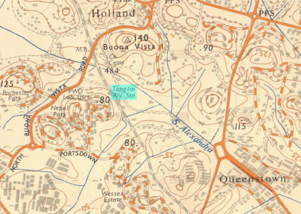
Tanglin Halt Railway Station - briefly mentioned in my book, Jalan Singapura - opened in 1932, part of the railway line running from Tanjong Pagar in the south to Woodlands in the north, and then across the Causeway to Malaya.
The railway station was named “Halt” because trains stopped there; as for “Tanglin”, it was an oddity as it was nowhere near Tanglin or Tanglin Road. The nearest trunk road to the station was Buona Vista Road (later North and South Buona Vista Road).
Over the next three decades, the station would close and open multiple times, a tussle between low passenger usage and the need for a stop to serve the surrounding area.
The sparsely-populated rural countryside around the station gradually receded by the early 1960s. Queenstown New Town, Singapore’s second satellite town after Toa Payoh, was expanded to the west, from the Alexandra Road area to the railway tracks.
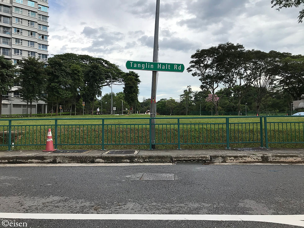
The HDB estate of Tanglin Halt, and the roads of Tanglin Halt Road and Tanglin Halt Close, came up next to the station, and were named after it.


The land around the loop formed by Tanglin Halt Road and Commonwealth Drive was filled with the HDB flats of Tanglin Halt Estate. As for the 20 acres of land around the triangular loop formed by Tanglin Halt Road and Tanglin Halt Close, it was taken up by Tanglin Halt Industrial Estate, managed by Jurong Town Corporation. There were 38 lots for cottage industries such as textiles, woodworks, electronics, and chocolate.
On the map, that made sense: The site was next to the HDB flats, which were a ready source of labour; it was also next to the railway station, which, though closed to passenger traffic then, could still be an option for the transport of raw materials and goods to and from Malaysia.
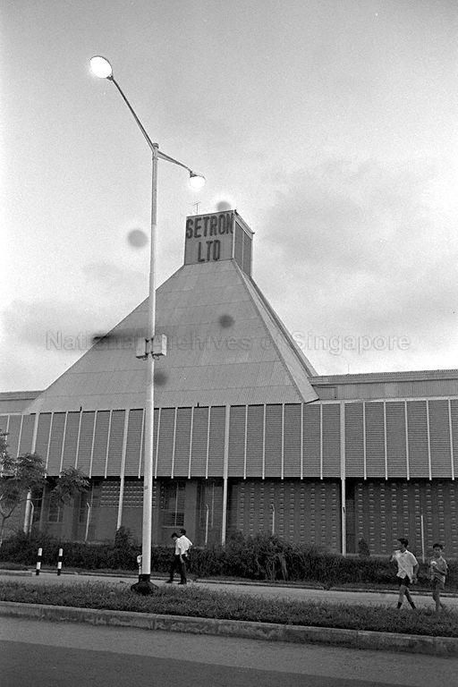
By 1966, Tanglin Halt Close was lined by low-rise factories and workshops.

There was a factory for Setron Limited, the first television assembly plant in Southeast Asia, which produced Singapore’s first locally-assembled black-and-white TV sets.
This was Lim Kah Ngam (Singapore) Limited, a woodworks factory.

There was also Daiwa Limited, a Japanese fishing equipment brand.

From the late 1980s, as Singapore’s manufacturing sector matured and larger industrial estates opened around the island, these companies began relocating from Tanglin Industrial Estate. The last newspaper advertisements for brands housed in the area petered out by the year 2000.

The roar of passing trains ceased in 2011, when the line between Tanjong Pagar and Woodlands closed for good, and the railway tracks were replaced by the Rail Corridor.
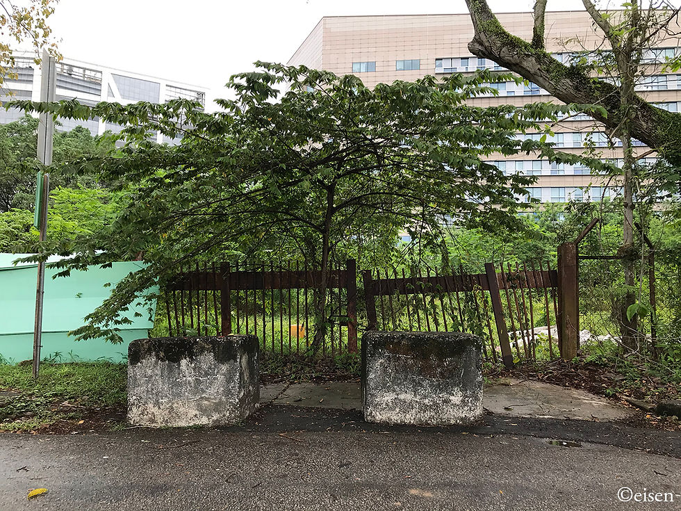
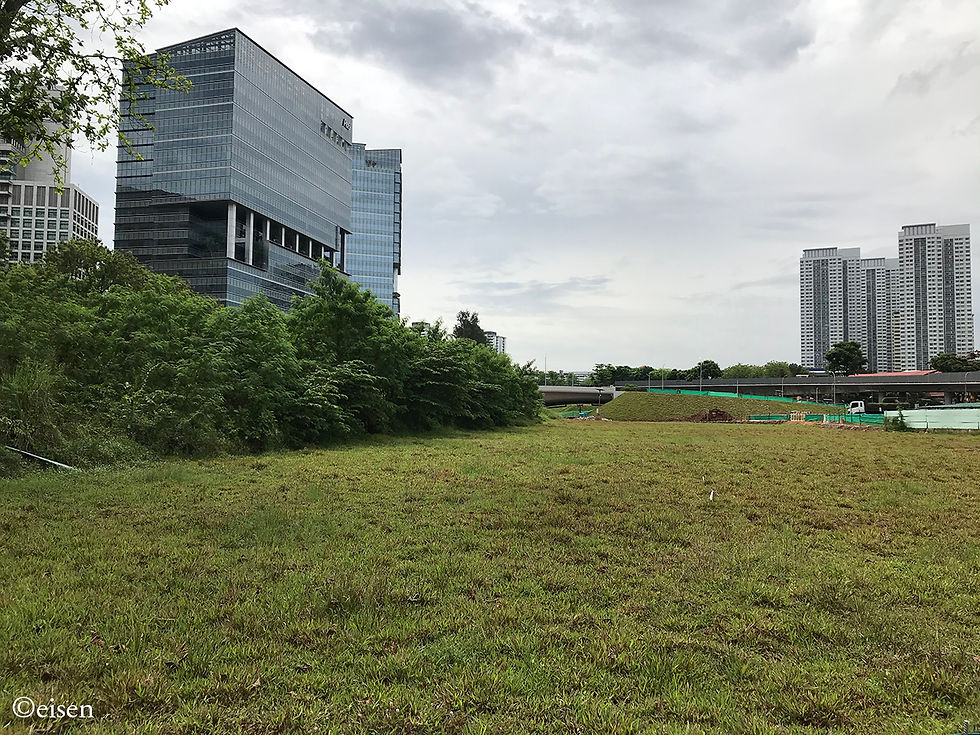
Sometime between 2000 and 2015, when I first visited the area, the buildings of Tanglin Halt Industrial Estate were torn down. All that’s left are an open field, and rusted fences and gates as the only evidence of the activities once held there.

And of course, there are the roads.
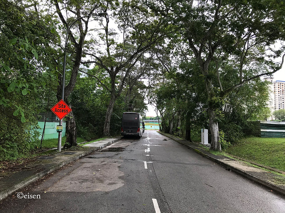
Tanglin Halt Road:
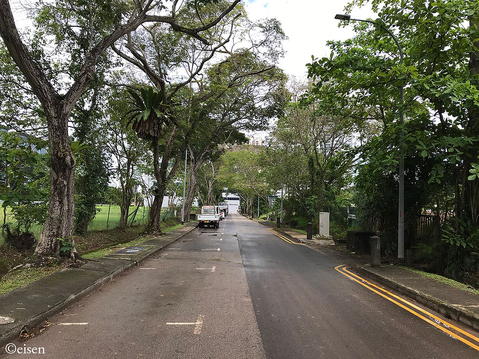
Tanglin Halt Close:
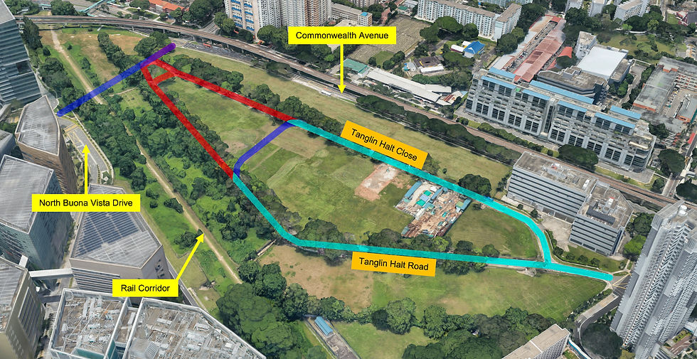
However, sometime between 2019 and 2020, the northern part of the original loop was shaved off.
The new northern part of the shrunken loop is clearly marked out by the fresh, white, recently-laid pavement.
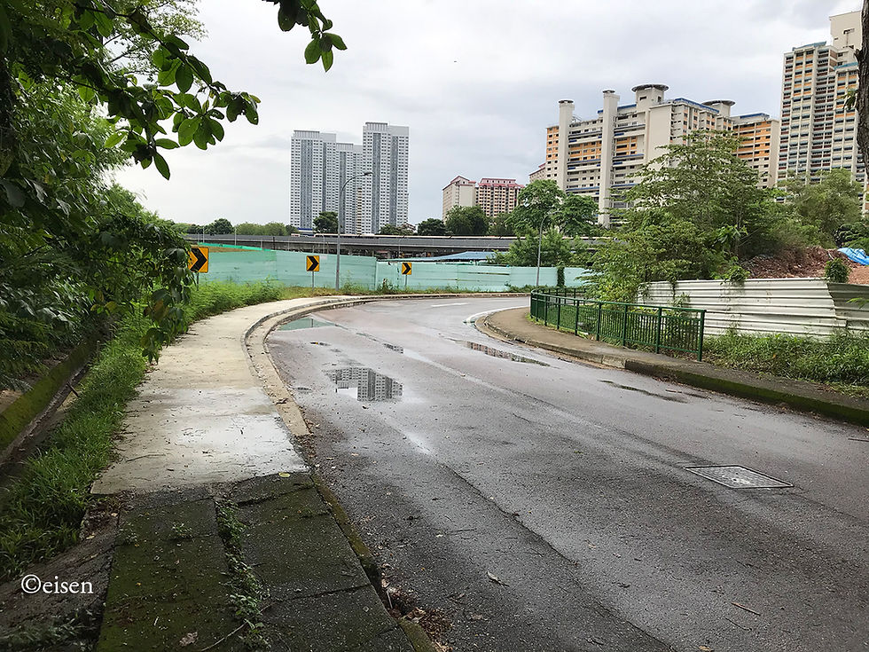
Here, the original pavement has given way to the new pavement.

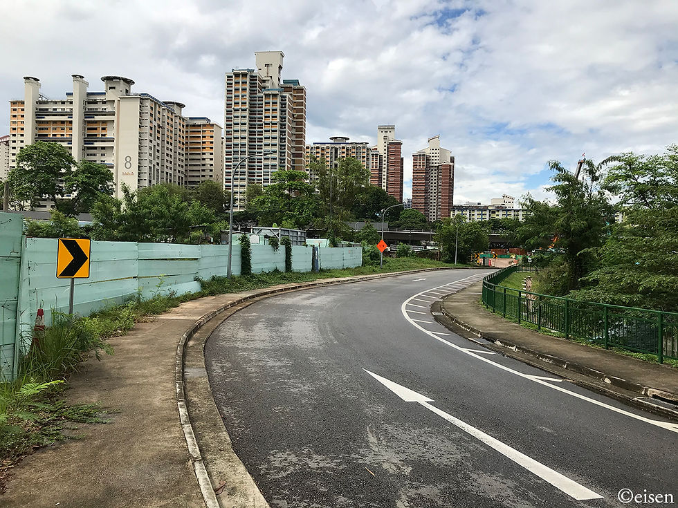
The new northern part of the loop, where a newly-laid section of Tanglin Halt Road gives way to a newly-laid section of Tanglin Halt Close:
Behind hoarding, an original stretch of Tanglin Halt Road has been expunged and covered with fresh grass.
The reason for the shaving of the loop could be this: What looks to be a new road overhanging the Rail Corridor, linking North Buona Vista Drive and the Biopolis complex to Commonwealth Avenue.

This aerial shot shows the recent changes to the Tanglin Halt Road-Close loop: What’s left of the original loop is shaded light blue, what’s expunged is shaded red, while new road is shaded dark blue.
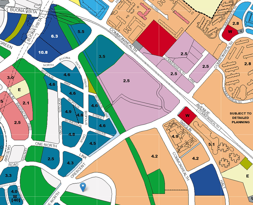
The rest of the historic loop is on borrowed time. According to the 2019 URA Master Plan, the area is slated for redevelopment into a business park. The loop does not even appear on the Master Plan map.
Most of Tanglin Halt Estate itself is also slated for redevelopment very soon, under the Selective En-bloc Redevelopment Scheme. More of that in another post.


