top of page

Blog

Blog Picture.jpg
Search
  • Mar 5, 2021

I visited Seng Chew Quarry, a disused granite quarry which once supplied the hardy material for the construction of buildings and roads in Singapore.


Seng Chew Quarry was one of several quarries which scarred the line of hills presently running down the right side of the southern part of Choa Chu Kang town and the northern part of Bukit Batok town. The hills included Bukit Panjang, Bukit Gombak I, Bukit Gombak II, and Bukit Batok, ranging from 294 to 434 feet in height (Bukit Timah Hill’s taller than all of them at 537 feet). The quarries included Ideal Home, Lian Hup, Seng Chew, Gammon, and Poh Kim. Whatever’s left of Ideal Home and Lian Hup now lie inside Bukit Gombak Camp, Gammon’s lake is Little Guilin, and the remains of Poh Kim is a lake inside Bukit Batok Nature Park.


The 1961 map below shows the hills in blue and the quarries in yellow:

Base picture credit: National Archives of Singapore.

Seng Chew Quarry lies on the slopes of Bukit Gombak I, as seen in the Google Maps image below. Most of the hill is off limits, no thanks to Bukit Gombak Camp.

Base picture credit: Google Maps.

Access to Seng Chew Quarry was surprisingly easy, and the route hasn’t been fully manicured by the authorities yet, although I’m not sure for how long more this will be the case.


I took the train to Bukit Gombak MRT Station on the North South Line, took Exit D, and walked past the Bukit Gombak Sports Hall to Block 383 Bukit Batok West Avenue 5.


Next to the block was rising terrain, which I guess had been neatly sculpted and planted over with grass. A storm drain had also been installed to aid in drainage.

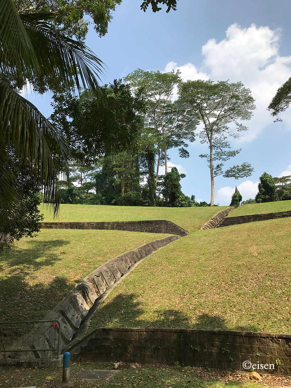
I climbed up the hill to where the grass ended and the forest began (Location A below). (The path I took during my exploration is marked in light blue.)

Base picture credit: Google Maps.

The slopes of Bukit Gombak I as I climbed the hill.

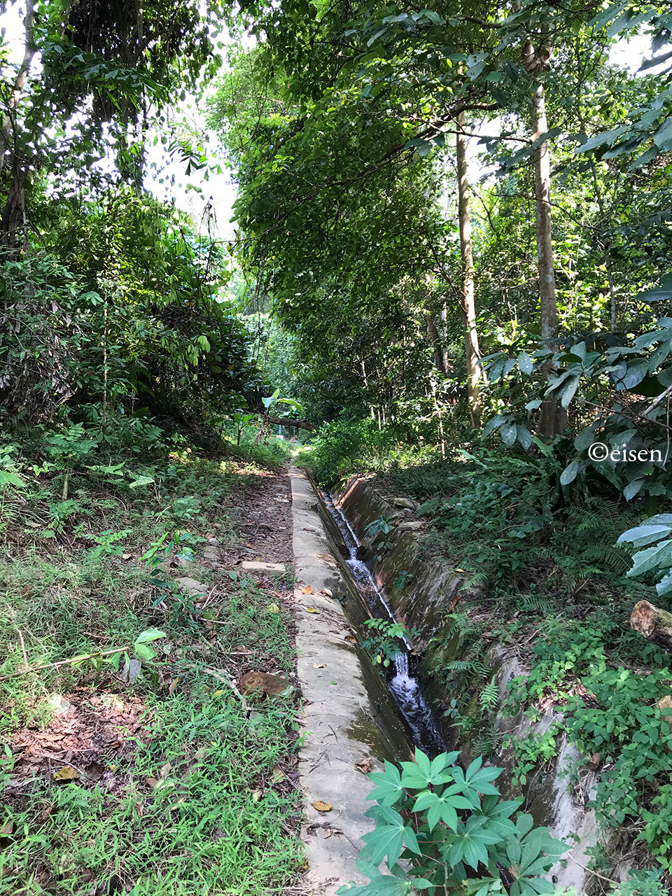
Where the grass ended and the forest began, there was the sound of a flowing stream - it was water draining out of the quarry lake.

I read online that the water had magical properties. No, I did not drink it; I did wash my hands with it, but nothing has happened to them yet.

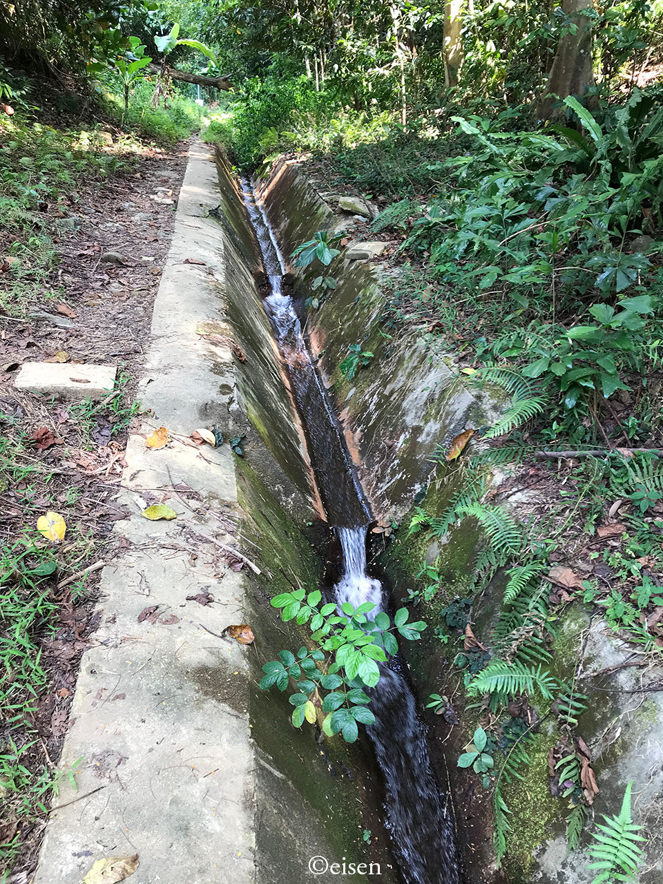
I followed the stream and ventured into the undergrowth. There was forest on both sides but the stream made it easy to head in.


Further in, there was a fallen tree lying across the path, but it was easily scaled.

It took me fewer than two minutes to reach the quarry lake.

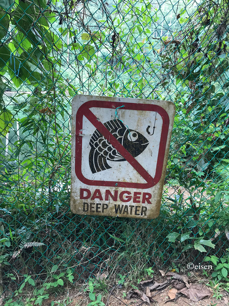
There was an opening on the left side of the fence, which allowed me to go right up to the edge of the lake.


All was quiet and peaceful. Only the low calls of birds and insects broke the silence.

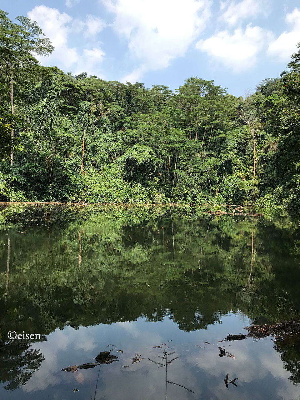
The lake was very still. I wondered how deep it was. I’m sure people have drowned in it.


Near Location A, starting at Location B, there was a path running uphill through thick undergrowth. This was the view from Location B.

The uphill path ended at a clearing at the top of a rocky outcrop which gave an excellent view of the quarry and its lake.


From this vantage point, the size of the quarry was clear to me.

Here’s proof that I was there!

If I was a resident of the nearby flats, I’d come here every week to commune with nature! I hope the authorities leave this place as it is.


Chanced upon this short essay submitted to The Straits Times by a Secondary 3 Changkat Changi Secondary School student in 1978 (he / she would be 58 years old now).

The author wrote this at a transition in Singapore’s post-independence history - the Republic was in the midst of constructing New Towns filled with high-rise flats, while clearing rural kampungs and agricultural communities; however, the island still had plenty of both. Hence, it was the opportune time to weigh the pros and cons of living in either habitat.


What tickled me was the innocent manner in which the student wrote about the “dangers” of living in high-rise flats: Little children “may fall through the windows”, while “people living on the higher floors tend to throw rubbish and things down through their windows”.


Also, the author was one of a small group of students who lived on one island and studied in another! He / she lived in Pulau Tekong Besar, but went to school on the mainland.

A Malay village in Pulau Tekong Besar. Credit: Pinterest.

Pulau Tekong Besar’s residents were resettled to the mainland by the late 1980s.


Seven years into Singapore’s official car-lite drive, and the authorities have initiated the Republic’s largest push yet to convert road space to cycling paths. Better late than never!


More than 20 roads in the northeast of Singapore and the eastern parts of the island will be assessed to determine if portions of them can be reclaimed for cycling paths, in what is likely to be the first such study on this scale.


They include stretches along heavily utilised roads such as Aljunied Road, Braddell Road, Upper Serangoon Road, Upper Paya Lebar Road and MacPherson Road.


Should all plans come to fruition, experts said the additional paths - part of a national plan to boost Singapore’s cycling path network to 1,300km by 2030 from 460km now - will significantly improve convenience and safety for cyclists.


They told The Straits Times that the traffic study to be done is the largest they have heard of so far in relation to converting road space to cycling paths. It is one of various initiatives in Singapore’s push to become a car-lite nation.


According to tender documents seen by ST, the Land Transport Authority (LTA) is seeking engineering consultancy services to design cycling paths and related infrastructure in the eastern sector.


Plans for the construction of the cycling paths are spread out in three phases till 2030.


The potential conversion of road space would contribute to the expansion of networks in several areas over the next decade.


Estates that could significantly benefit include Geylang, which is slated to have an additional 29.5km of cycling paths, Sengkang (28.3km), Hougang (28.2km) and Serangoon (27.6km).


Industrial areas, such as those in Pasir Ris (6.6km), Tampines (3.6km) and Bishan (1.6km), could also get cycling paths should feasibility studies come through.


The proposed new paths should connect to the existing path properly, LTA said. Where necessary, existing roads, junctions and facilities should be realigned, reconfigured or reconstructed to do so.


The LTA said the studies on identified roads will analyse the traffic impact that the cycling path proposals would have on surrounding roads. Tender applicants should propose localised road improvement schemes to meet traffic demands where necessary, it added.


Associate Professor Walter Theseira, who heads the Master of Urban Transport Management programme at the Singapore University of Social Sciences, said the studies address the issue of lack of space to build cycling paths along some key routes.


On why major roads are being looked at, he said: “If you want to implement a good high-speed commuter cycling network, there is often going to be no choice other than to align the network with the existing arterial road network. The arterial road network is there for a reason - it happens to be the path that is most convenient for a larger number of commuters.”


Mr Gopinath Menon, a transport engineering consultant, noted that cyclists are allowed to use normal road lanes, but many refrain from doing so because they feel unsafe.


Drawing parallels to the decision to introduce dedicated bus lanes, he said that while it had some impact on traffic, there was a strong case to give priority to buses as they are “efficient movers of people”.


“Similarly, bicycles are an eco-friendly mode of transport that the Government wants to encourage.”


But he added that it is unlikely that all the roads being studied will be partially reclaimed for cycling paths, due to traffic considerations...


***


LTA will also study the feasibility of removing parking spaces along four roads in the Joo Seng-Tai Seng area: Joo Seng Road, MacTaggart Road, Kim Chuan Road, and Tai Seng Avenue.


The current roadside parking offered at Kim Chuan Road:

Credit: Google Maps.

And at Tai Seng Avenue:

Credit: Google Maps.

Up to 1977, roadside parking was the norm along Singapore’s roads, but from that year, it was gradually phased out, to hand over valuable road space to moving traffic - my book Jalan Singapura covers that. Now, it’s long overdue that LTA phases out whatever’s left of roadside parking. It should be reserved for only the most remote or underused of roads.


Copyright © 2025 Eisen Teo. Proudly created with Wix.com

bottom of page